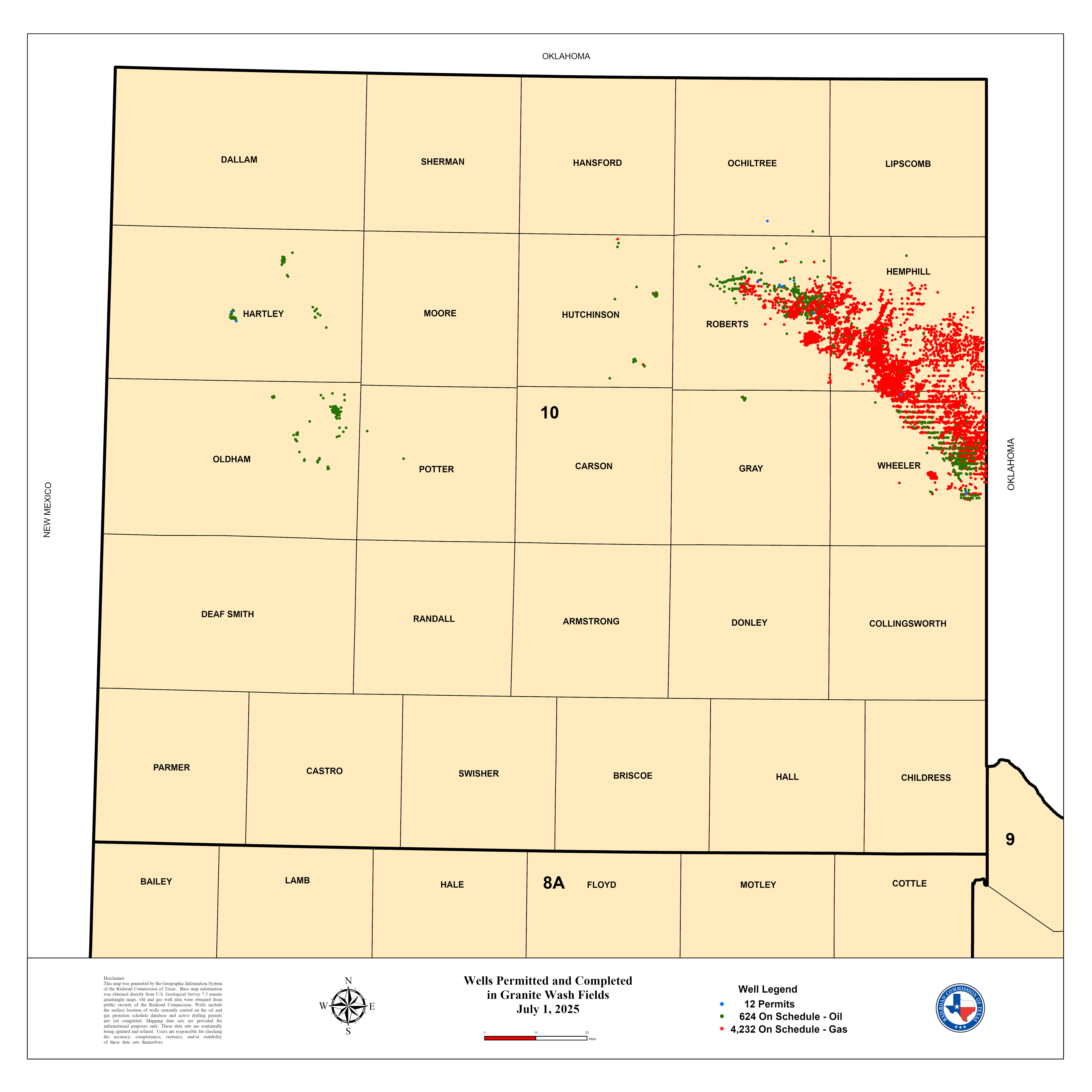


Granite Wash
Information & Statistics
What is the Granite Wash?
The Granite Wash is a tight sand play located in the Texas Panhandle (Railroad Commission of Texas District 10) and Western Oklahoma. It is a significant field for both oil and gas production and, although the formation is predominantly composed of sand, has been a beneficiary of horizontal drilling methods developed for shale plays. The name Granite Wash is a catch-all term that refers to a number of oil and gas producing formations, mostly Pennsylvanian in age. The area covered by the Granite Wash is approximately 160 miles long and 30 miles wide. It varies in depth from 11,000 to 15,400 feet and is 3000 feet thick on average. Productive horizons in the Granite Wash are actually several washes formed by detritus from the Wichita-Amarillo uplift. As a result, stratigraphic nomenclature for productive formations in Granite Wash fields varies considerably. A few common names include: the Desmoinesian series, Atokan and Cherokee groups, and the Kansas City group. For tight-gas classification, the Granite Wash-A or Cherokee Marker horizons are commonly used to designate the top of the interval on gamma ray logs. The bottom of the Granite Wash is typically marked by the Thirteen Finger limestone or the top of the Morrow shale.
Disclaimer: This data is a snapshot in time displaying production data from the RRC’s Production Data Query System (PDQ) based on the extract date.
Statistics